
The standard
How to tell whether to believe us
This page exists so you do not have to take anything else on this site on trust. It is the shortest useful description of what we will and will not do.
What we claim
- What the data shows, at the confidence the data actually supports.
- What a method found, and what the same method failed to find.
- That a question is open, when it is open.
What we never claim
- A number, date, site or outcome that does not trace to a named primary source.
- That a lost civilisation existed, unless the evidence is published and we cite it.
- Certainty we do not have. On this site, we do not know is a finished sentence.
- That an absence of evidence is evidence.
The test
Every sentence containing a number, a place, or a claim gets the same check before it ships: if a hostile reader went after this with a search engine, would it hold? If we are not certain, it carries an unverified mark until we are. A precise false claim does more damage than a vague true one, every time.
The five labels
Every published claim carries exactly one. There is no sixth label and nothing ships without one.
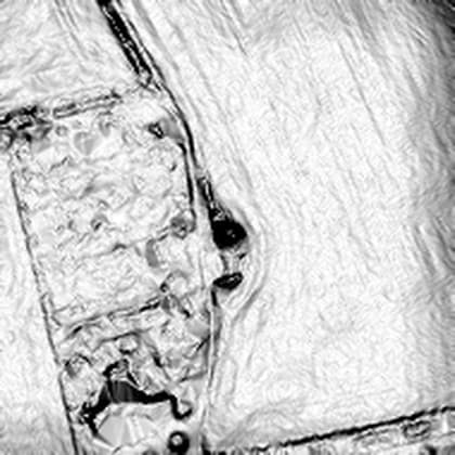
In a peer-reviewed paper or an official heritage record. Cited.
Round barrow NE of Hog Hill Barn, list entry 1003237
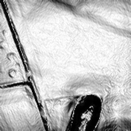
Our detection surfaced it. Not verified. An interesting shape, nothing more.
One of three Dorset depressions we cannot resolve
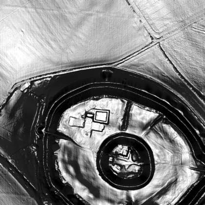
Reported to the heritage authority. Awaiting their response.
Old Sarum, formally on the record
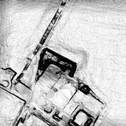
Checked and explained. Published anyway: negatives prove the method is honest.
The farmyard run 001 ranked second in 6 square kilometres
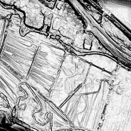
Someone else's claim, under examination. Reporting is not endorsing.
Open ground, nothing resolved
Reporting before publishing
If our own detection surfaces something in England that survives desk checking, it goes to the county Historic Environment Record and to Historic England before it appears here. Following the procedure is not a constraint on what we are doing. It is the thing we are doing.
Licences, and where the data comes from
Every dataset, map tile, image and print carries a licence field. If that field is empty, it does not ship. It is why our own survey work starts on English elevation data, which can be used commercially with attribution, rather than on research data that is not ours to build on.
You can check all of it yourself:
- Environment Agency LIDAR Composite DTM, 1m is the elevation data behind every terrain plate on this site. Roughly 99% of England.
- Open Government Licence v3 is the licence it is published under. Commercial use permitted, attribution required.
- The National Heritage List for England is the ground truth every run is scored against, published by Historic England, also under the Open Government Licence.
- Historic Environment Records are where a surviving candidate gets reported, before it appears here.
Contains public sector information licensed under the Open Government Licence v3.0. Historic England data contains Ordnance Survey data, Crown copyright and database right.
Common questions
- Does Before the Record claim lost civilisations existed?
- Only where the evidence is published, and then we cite it. Where a claim is somebody else's, we label it speculative and attribute it. Reporting a claim is not endorsing it.
- What happens when a find turns out to be nothing?
- We publish it as refuted, at full prominence, with the explanation. Negative results are how you can tell the method is honest rather than decorative.
- What does unverified mean on this site?
- It means we could not trace the claim to a named primary source. It stays marked until we can, or it is removed. A precise false claim is worse than a vague true one.
- Where does the elevation data come from, and can anyone use it?
- The Environment Agency LIDAR Composite Digital Terrain Model at 1 metre resolution, which covers about 99 per cent of England. It is published under the Open Government Licence version 3, so anyone can use it including commercially, provided they credit the source. That licence is why our own survey work starts in England rather than anywhere more famous.
- How do you know a candidate is not already a known monument?
- Every run queries the National Heritage List for England, which Historic England publishes under the Open Government Licence, for the same ground. The run reports how many known scheduled monuments it recovered before it is allowed to report any candidates, and that number is published whether or not it flatters the method.
- What happens if you find something real?
- It goes to the county Historic Environment Record and to Historic England before it appears here. Following the procedure is not a constraint on the project. It is the project.
- Are the images on this site real data or illustration?
- Both, and every image says which. Terrain plates are real Environment Agency elevation data rendered by us, and carry the dataset, the licence and the render settings. Anything generated is captioned as brand imagery, not survey data. No image is ever presented as evidence unless it is.
- Why does the scoreboard show more refuted than confirmed?
- Because that is what happened. Four survey runs over the same six square kilometres of Dorset produced 269 candidates and one confirmation, and the confirmation is a barrow that was already protected. A method that only publishes its successes tells you nothing about what it misses.
Fiction is kept separate
The person who writes this also writes science fiction, including a series about an ancient civilisation that never existed. That work never shares a name, a logo, or a page with this one. Where we examine what a novel or a documentary imagined, the page says so at the top.